In this section, we present results obtained using the HMMWV in a cross-country test area. In all the examples, the homography of the reference plane is computed on an initial image by using up to ten features on the ground plane. The relative height, stereo matching and rectification use the algorithms of Section 2.1 and Section 2.2. The evaluation of relative slope is not yet integrated in the system. Three hundred points are used in a typical configuration of the system. The computation times are 0.1s for the arc evaluation and 0.5s for stereo matching and rectification on a Sparc-10 workstations. The navigation module runs on a dedicated workstation while the other modules, such as the DAMN arbiter, run on a separate workstation.
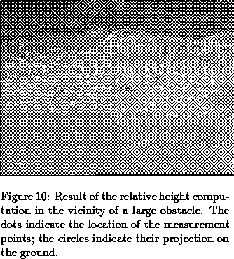
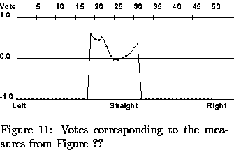
The first example (Figure 10) shows a large obstacle in front of the robot, on the right. The small white dots are the points that have been measured, and the white circles are their projection on the ground. The bump has been detected since all the measured points located on its surface have been correctly projected at the bottom of the bump, on the ground plane. The corresponding votes are shown in Figure 11. The votes corresponding to the arcs on the left of the obstacle have a much better value than the ones going in the direction of the obstacle. The votes for the arcs on the extreme left and right are set to -1 because they are not visible in the image.
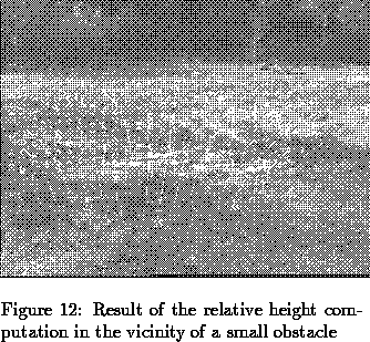
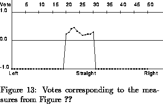
The example in Figure 12 is similar; a small bump on the right has been detected. An interesting observation is that the votes corresponding to the arcs going toward the obstacle (Figure 13) have a value bigger than the ones going toward the obstacle detected in the first example (Figure 10). The reason is that the obstacle in this example is smaller than the one in the first example.
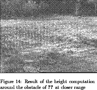
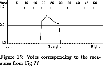
In the third example (Figure 14 and Figure 15), the robot is closer to the obstacle. Therefore, this time, the votes corresponding to the arcs going toward the obstacle have a smaller value than before (compare Figure 13 and Figure 15). This is because both the distance and the height of the detected obstacles are taken into account during the computation of the votes.
We demonstrated this initial system over short paths in our test site. We processed up to one hundred images over a single path. Our current work involves adding a module that keeps a history of all the votes instead on relying solely on the votes from the most recent image, and integrating the slope computation into the system. These two extensions will make the system more robust and will allow for longer demonstrations. We are also automating some aspects of the system, such as the selection of the features in the initial training images of the reference plane. Longer-term goals include moving the system to the Ratler and using two pairs of cameras for increased field of view.